GPR INVESTIGATION
Operating since 2006. Loza-based geophysical investigations for mineral exploration, hydrogeology, engineering geology and archaeology. Investigation depth up to 200 m.
Contact USOperating since 2006. Loza-based geophysical investigations for mineral exploration, hydrogeology, engineering geology and archaeology. Investigation depth up to 200 m.
Contact US
Operating since 2006, GPR INVESTIGATION specializes in Loza-based geophysical investigations for complex subsurface challenges in mineral exploration, hydrogeology, engineering geology, and archaeological research.
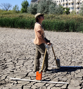
Our approach uses Loza-N systems—low-frequency transient electromagnetic instrument designed for analysis of dual-regime (wave-diffusion) responses. This methodology enables investigation of geological structures and conductive bodies to approximately 200 meters depth, depending on site conditions.
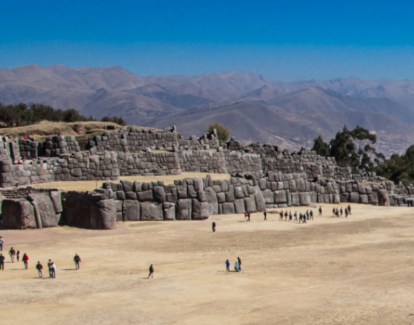
Field experience spans 63 countries across 5 continents, from greenstone belts in Zimbabwe, copper belt in Zambia to archaeological sites in Peru, working in diverse geological and climatic environments.
Find out MoreSince 2006, we have delivered geophysical investigations in mineral exploration, hydrogeology, geotechnical studies, and archaeology, focusing on projects where conventional methods face limitations.
Our team combines field geophysics expertise with practical deployment experience in Loza systems. We specialize in environments where standard high-frequency GPR lacks penetration and classical TEM lacks structural resolution.
The Loza methodology operates in the transitional frequency range between ground-penetrating radar and time-domain electromagnetics, capturing both structural (early-time) and conductive (late-time) signatures in a single dataset. This dual-regime approach is particularly effective for mineralized systems, aquifer mapping, and subsurface profiling beneath freshwater bodies.
Find out MoreUp to ~200 m in favorable conditions (site-dependent, geology-specific)
Rapid data collection with real-time field interpretation
Adjust survey parameters based on preliminary results
Preliminary analysis during data acquisition for survey optimization
Secure field acquisition and controlled data processing
Deployable in remote and logistically challenging environments


In recent years the employees of Sacsayhuaman archaeological complex witnessed a number of destructive processes taking place at certain sites of the complex. These consisted of large cracks appearing in the main walls, shifting of stone blocks, and recession of the walls.
Such trends may lead to irreversible and unrecognizable changes to the complex, which remains one of the most significant monuments of Inca heritage. This issue raised a need to conduct a research investigation...
Read All Articles