
Before commissioning a water well, a landowner may ask a simple question: where should the rig stand? A useful investigation turns that question into a plan: what ground conditions are plausible, which locations deserve testing, and what evidence will be needed before a dependable supply can be assessed.
A geophysical survey can contribute to that plan. Its value depends on the geological setting and the decision it is meant to support. The starting point should be the intended water use and the information already available about the site.
Start with the water requirement
A household supply, seasonal irrigation and a commercial operation can have different requirements. Tell the investigation team how the water will be used, when demand is greatest and whether storage is being considered. This gives the hydrogeologist a practical question to investigate, rather than an isolated request to find a promising mark on a map.
Nearby well records can add context. Useful details include the drilled sequence, construction, water levels and any documented performance tests. Their relevance depends on how closely their geological setting resembles the proposed site. The USGS explains that permeability influences whether a well can provide an adequate supply; water levels can also respond to drought and nearby abstraction. Read the USGS introduction to groundwater wells.
What GPR can investigate
Ground-penetrating radar records electromagnetic responses from the subsurface. Under suitable conditions, it can help investigate boundaries, the shape of bedrock and zones of changing ground properties. Such features may be relevant to a hydrogeological interpretation. The US EPA describes these applications and their limitations.
Site conditions also affect the measurement. Conductive materials, including some clays and saline groundwater, can strongly limit penetration. There is no single investigation depth that applies to every property. A survey proposal should explain the expected usefulness of the method at the particular site and how its suitability will be assessed.
A marked zone is a hypothesis to test
A change in a radar section does not identify a productive aquifer by itself. The EPA notes that geophysical responses do not have a unique relationship with geological or hydrological properties. Interpretation therefore needs context and, where possible, calibration against direct observations.
When reviewing a proposed target, ask for the evidence behind it. What was measured? What geological explanation is being suggested? Which other explanations remain possible? What observation would help distinguish them? These questions make uncertainty useful: they help define the next investigation step.
What drilling and testing still need to establish
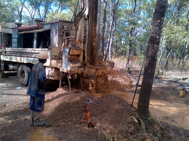
Drilling provides access to the ground and water at the selected location. Cuttings, cores and borehole logs can help check the interpretation used to select the site. The USGS describes how geophysical logs contribute information about the rocks and fluids encountered. See the USGS manual on borehole geophysics.
Well performance then needs appropriate testing. Agriculture and Agri-Food Canada explains that useful pumping-test records include elapsed time, discharge and drawdown. Water quality is another part of evaluating a supply. A surface survey alone cannot establish a well’s sustainable output or drinking-water suitability. Read Canada’s guidance on well monitoring.
Make the survey brief useful
Before requesting a quotation, assemble a site plan, the intended water use, available geological information and nearby well records. Mark access restrictions and the area in which a borehole could realistically be installed. If there is an existing well, include its construction details and any recorded changes in performance.
Ask the contractor to connect each proposed deliverable to a decision. A map should show where the interpretation applies. A section should explain its position and scales. Recommended targets should state why they warrant investigation and what remains to be verified. This creates a clear handover between geophysics, hydrogeology and drilling.
Send GPR Investigation your site information and project question. We can discuss whether geophysics could contribute, which limitations matter and how the work could fit into the wider investigation.