Archaeology
Search and location of archaeological remains
Search and location of archaeological remains
Archaeology for us is not a service package. It is part of our professional history and respect for cultural heritage. Most of these projects were carried out for universities, expeditions, and scientific institutions — often as research support for funded expeditions. We work exclusively with official organizations: museums, research institutes, heritage protection foundations, and academic groups.
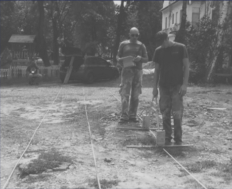
Archaeological surveys are conducted with the Loza-V high-frequency system, which maintains resolution and penetration in geologically challenging conditions typical of cultural heritage sites:
This makes Loza-V effective precisely where most standard electromagnetic methods fail — in the soil conditions most common across Eastern European, Central Asian, and African archaeological landscapes.
The goal is simple: see what is hidden before anyone touches the ground.
If you represent a museum, university, research institute, or a heritage protection foundation — contact us. We support missions where the work has scientific meaning.
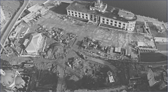
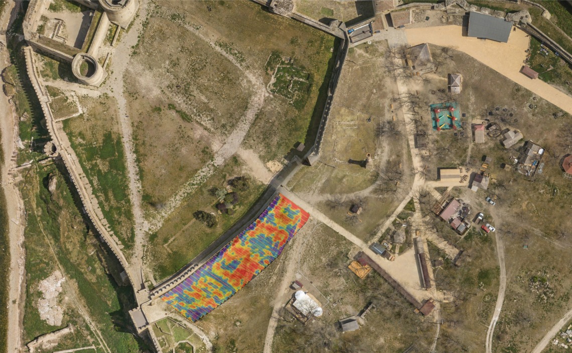
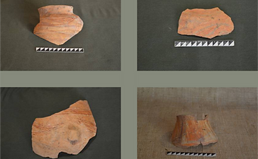
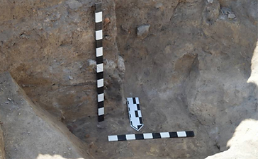
Survey conducted at one of Kyiv's most significant historical sites — Poshtova Square, a major cultural and archaeological node in the city's medieval landscape. The Loza-V system was used to map cultural layers through the heavy urban fill and clay-rich soils typical of the Dnipro riverbank terrace.
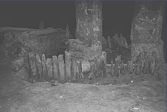
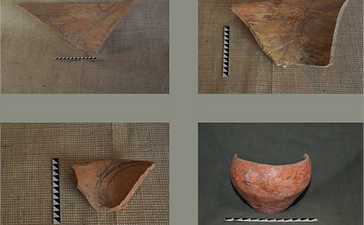
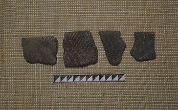
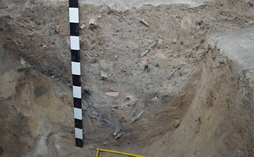
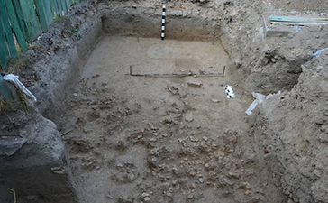
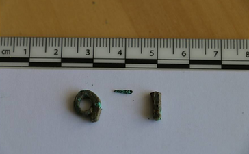
Excavations following the survey identified cultural layers from the XI–XIII, XV–XVI, and XVII–XVIII centuries. Finds included ceramics, decorations, glass, and organic remains. The electromagnetic survey guided trench placement and confirmed stratigraphic boundaries before excavation.
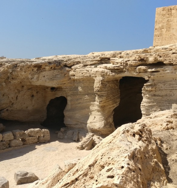
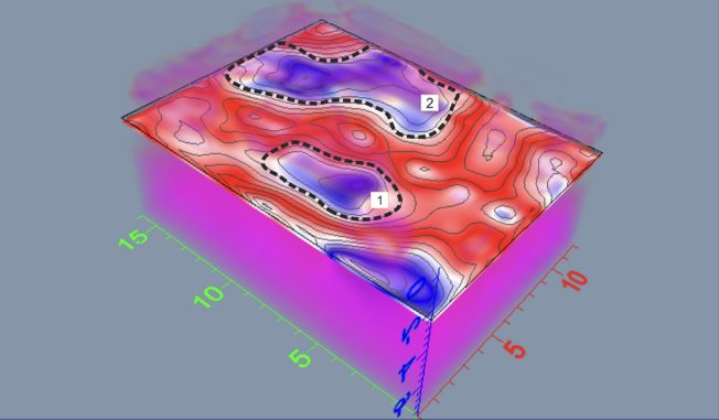
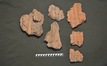
The Cucuteni–Trypillia culture (c. 5200–3500 BC) extends across the Carpathians to the Dniester and Dnieper regions — one of the largest Neolithic settlement cultures in Europe, covering approximately 350,000 km². Sites are located predominantly in chernozem (black soil) terrain with high clay content — a geologically challenging environment for standard electromagnetic methods.
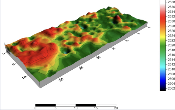
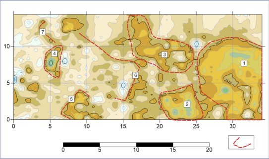
The Loza-V system was selected specifically for its ability to maintain signal quality in heavy chernozem soils, where conventional systems lose penetration depth rapidly. Survey results were used to produce 3D structural models of buried settlement features without surface disturbance.
The Loza-V high-frequency system maintains signal quality in clay-rich soils, chernozem, and highly mineralized ground — the soil types most common at archaeological sites across Eastern Europe, Central Asia, and Africa. Conventional electromagnetic systems and standard GPR units lose penetration depth rapidly in these conditions. Loza-V was designed to operate effectively where other systems cannot.
In typical archaeological settings — clay, chernozem, or mixed sediment over cultural layers — the Loza-V system resolves features to 3–8 m depth, sufficient to map most historical and prehistoric cultural horizons. Depth depends on local soil conductivity, moisture content, and target contrast. We assess expected resolution during project planning.
Buried walls, foundations, and stone structures; pit fills and storage pits; stratigraphic boundaries between cultural layers; voids and burial features; disturbed soil zones indicating former activity; ditches and enclosure features. Detection depends on the contrast between the feature and surrounding soil — stone walls in clay-rich soil, for example, produce a very clear response.
Yes. We have conducted archaeological surveys in multiple countries and can mobilize internationally. Past projects include sites in Turkey, Central Asia, South America, and across Eastern Europe. We work with official scientific organizations, universities, and heritage institutions — we do not undertake private or unauthorized surveys.
Processed electromagnetic sections along all survey lines; plan-view anomaly maps with feature positions and depth estimates; interpretation report identifying probable archaeological features; recommended excavation targets with priority ranking. All deliverables are provided in formats suitable for archaeological reporting and heritage documentation.