Why GPR Investigation
Electromagnetic Survey Expertise Built Over 20 Years and 63 Countries
We are not a general geophysical contractor. We operate one system — the Loza electromagnetic platform — and we have been developing methodology for it since 2006. That focus produces better results in the conditions where other methods struggle.
Since 2006
Operating continuously
63
Countries on 5 continents
~200 m
Investigation depth
Wave + Diffusion
Dual-regime response
What the Loza System Does That Other Methods Cannot
Most geophysical methods capture one type of subsurface information. The Loza electromagnetic platform captures two — simultaneously, in a single survey pass.
Early-time response — Wave regime
Structural imaging
At early times (0–500 ns), the Loza system operates in wave propagation mode. This resolves structural features: shear zones, quartz vein systems, fault geometry, lithological boundaries, and stratigraphic contacts.
In gold exploration, this means imaging the structural controls that host mineralization — before any drilling begins.
Faults · Shear zones · Veins · Contacts · Stratigraphy
+
Late-time response — Diffusion regime
Conductivity anomaly detection
At late times (1500–4096 ns), the system transitions to diffusion mode. This detects conductive zones: sulfide mineralization, graphitic units, water-bearing fractures, clay alteration, and saline groundwater.
In gold exploration, this locates the geochemical indicators — the sulfide halos that typically accompany orogenic gold mineralization.
Sulfides · Conductive zones · Aquifers · Alteration halos
One survey. One pass. Structural controls and geochemical indicators resolved together —
in the same section, at the same position.
This is the methodological basis for drill targeting that works.
We Work Where Standard Methods Struggle
Conductive terrain
Standard high-frequency GPR loses penetration rapidly in clay-rich, saline, or laterite soils. The Loza low-frequency system maintains investigation depth in these conditions — which cover most tropical, subtropical, and steppe geological environments.
Between wave and diffusion methods
Conventional TEM/TDEM provides conductivity response but lacks structural resolution. Standard GPR provides structural imaging but cannot detect deep conductive zones. Loza occupies the gap: structural detail at the frequency where diffusion becomes detectable.
Remote and difficult terrain
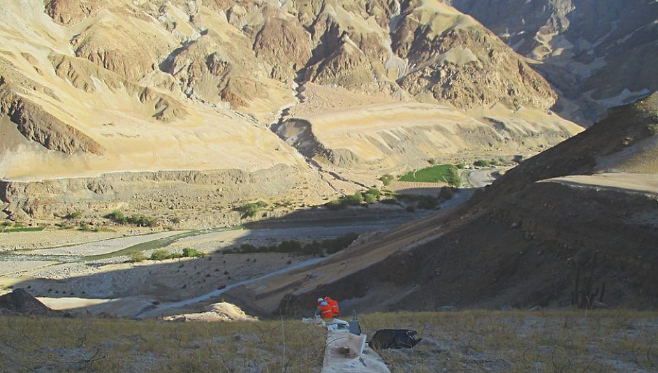
The system is portable and rapid to deploy. Up to 1 km of profile per 45 minutes in standard terrain. Proven in environments from -30°C glaciers at 4,500 m elevation to 95% humidity tropical conditions and Atacama-type desert at altitude.
Projects where prior methods failed
We frequently work on projects where standard GPR showed inadequate penetration, or where EM methods provided conductivity without structural context. Our dual-regime approach resolves both problems from a single dataset.
What you get
Practical deliverables, not raw data
Our team combines geophysics and geology experience, with field-tested workflows for planning, acquisition, QA/QC, and interpretation. Survey parameters are adjusted during acquisition based on early results — not fixed in advance and delivered unchanged.
Standard deliverables: processed profiles and sections, anomaly maps, depth estimates where applicable, and specific recommendations for follow-up work. Reports are written for geologists and engineers — not for other geophysicists.
Data confidentiality is standard practice. Project data is handled under controlled access from acquisition through to report delivery.
Investigation depth
Up to ~200 m in favorable conditions (site-dependent)
Rapid acquisition
Up to 1 km per 45 minutes — fast coverage without quality loss
Adaptive survey design
Parameters adjusted in the field based on early results
Field interpretation
Preliminary targets identified during acquisition — not weeks later
Data confidentiality
Controlled access and secure project data handling throughout
Remote-ready logistics
Proven in extreme terrain — desert, jungle, glacier, high altitude
Equipment
Loza Systems — Two Configurations for Different Conditions
Loza-N (low-frequency) is the primary system for mineral exploration and deep hydrogeology — maximizing investigation depth in resistive and semi-conductive terrain. Depth up to ~200 m in favorable conditions.
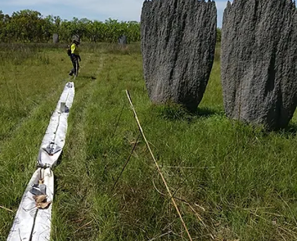
Loza-V (high-frequency) is optimized for shallow to moderate depth in challenging soil conditions: clay-rich soils, heavy chernozem, and highly mineralized ground where standard electromagnetic systems lose penetration. Primary system for archaeological surveys and near-surface engineering investigations.
Both systems produce dual-regime datasets — wave response for structural imaging and diffusion response for conductivity targets — processed and interpreted using the same AU Studio proprietary software.

Technical Specifications
- Up to 1 km of profile acquired per ~45 minutes depending on terrain and logistics
- Investigation depth up to ~200 m in favorable geological conditions — site-dependent
- Profile length does not limit depth — sections optimized for shallow high-resolution work or deeper investigation independently
- Survey parameters adjustable during acquisition to balance depth, resolution, and structural detail
- Dual-regime data processing: wave-regime structural interpretation and diffusion-regime conductivity analysis from the same dataset
- Suitable for remote areas and rapid-coverage programs where mobilization time is a constraint
Field Experience Across Extreme Environments
The Loza system has been operated in conditions that eliminate most alternative methods. This field history is part of the methodology — it produces survey designs that work in reality, not just in favorable conditions.

Glacier Denisov — Tien Shan
Kumtor gold deposit
Elevation: 4,500 m
Temperature: −30°C

Ituata — Peru
Gold deposit
Elevation: 2,700 m
Humidity: 95%

Atacama — Chile
Groundwater survey
Elevation: 2,160 m
Temperature: +10°C

Nazca — Peru
Copper deposit
Elevation: 1,900 m
Temperature: +32°C
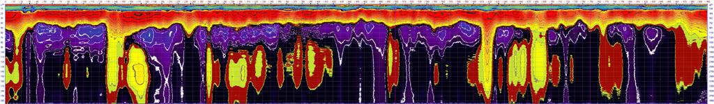
Interpretation Example
Porphyry copper deposit — raw section vs. interpreted section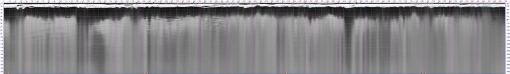
Loza-N Electromagnetic System
Low-frequency antenna system and pulsed transmitter — configuration varies by project depth and target type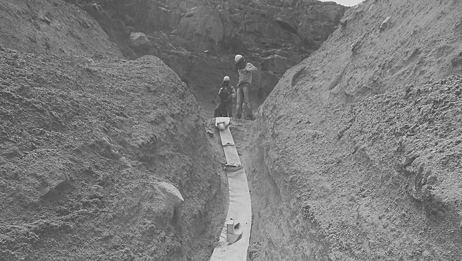
Questions About Our Methodology
What is the dual-regime electromagnetic method?
At low frequencies (25–50 MHz), an electromagnetic pulse propagates through the subsurface in two distinct physical regimes depending on travel time. In the early-time wave regime (0–500 ns), the signal behaves as a propagating wave and resolves structural features — faults, shear zones, contacts, veins. In the late-time diffusion regime (1500–4096 ns), the signal transitions to diffusion behavior and becomes sensitive to conductivity — sulfide zones, aquifers, alteration, clay. Both responses exist in the same dataset and are extracted through separate processing and interpretation workflows.
How does this differ from standard GPR?
Standard GPR operates at high frequencies (100–2000 MHz) and produces only wave-regime data — structural imaging at shallow depth (typically 1–10 m). The Loza system operates at 25–50 MHz, which extends investigation depth and introduces the diffusion regime at late times. This means Loza provides structural imaging at 50–200 m depth AND conductivity response from the same survey — which standard GPR cannot do at any depth.
What geological targets benefit most from this approach?
Orogenic gold deposits in greenstone belts — where structural controls (shear zones, quartz veins) and sulfide halos occur together at depth. Porphyry copper systems — where alteration zonation and structural corridors are both resolvable. Fractured aquifers — where fault geometry and water-bearing zones require simultaneous structural and conductivity mapping. Any target where knowing both structure and conductivity before drilling improves the quality of targeting decisions.
What are the depth limitations?
Investigation depth depends on subsurface conductivity, cultural noise, antenna configuration, and geology. In resistive terrain (granite, quartzite, dry sediments), effective depth reaches 150–200 m. In conductive terrain (laterite, wet clay, saline soils), depth is reduced — sometimes to 30–80 m. We assess expected depth range during project scoping based on available geological and conductivity data for the area.